|
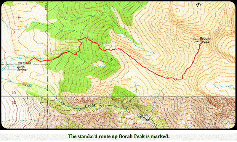
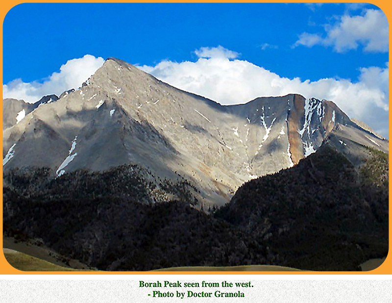
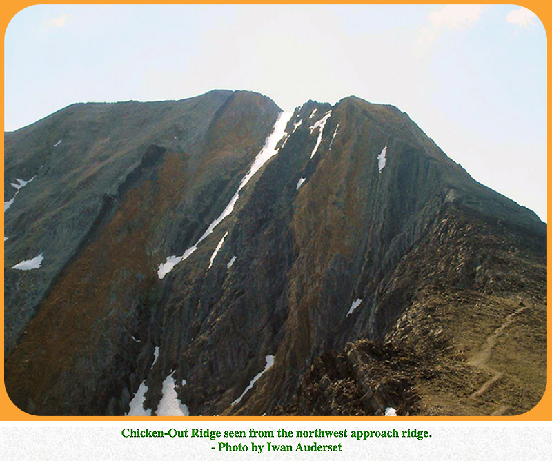
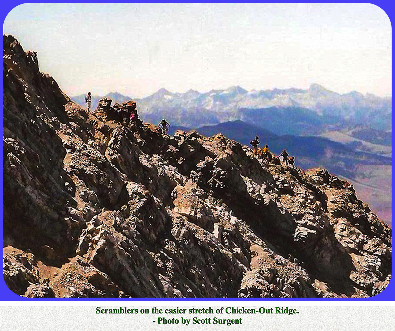
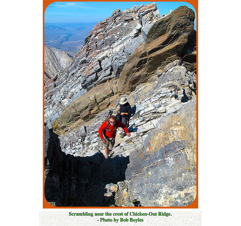
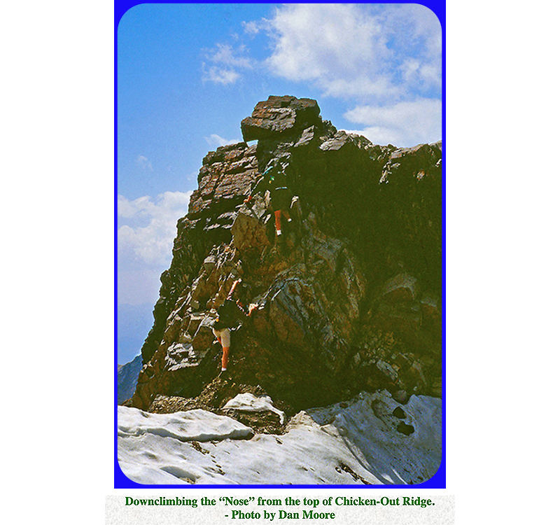
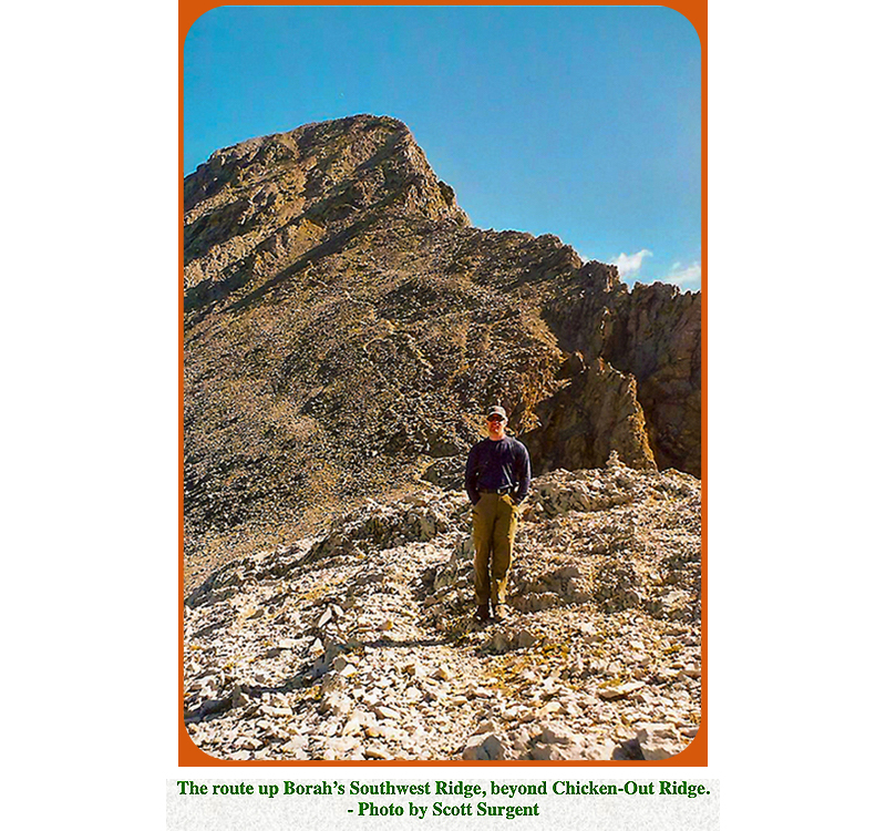
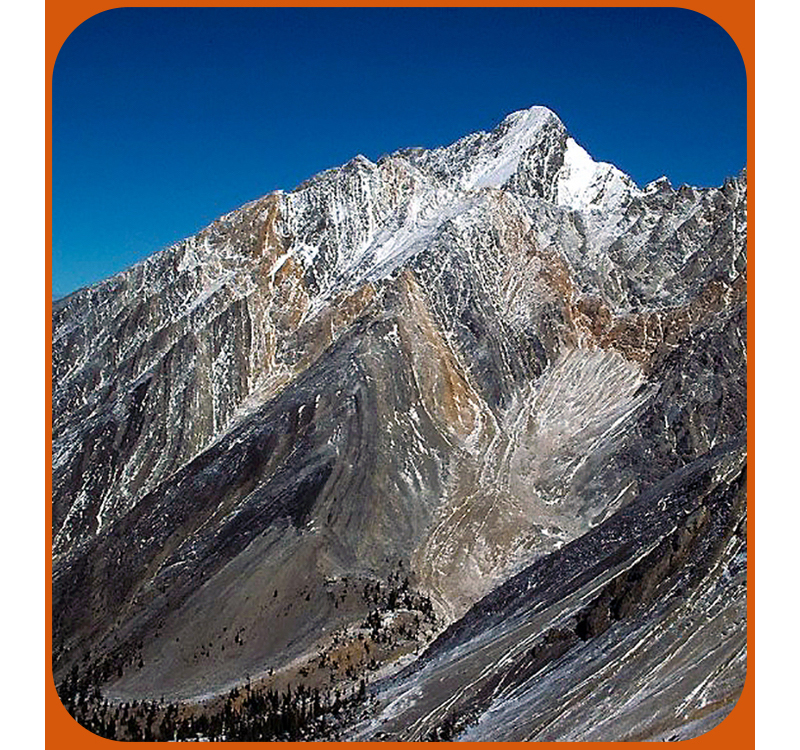
State Highpoints – Idaho - 12,662-foot Borah Peak Idaho’s highest peak and the 11th highest US state summit, 12,662-foot Borah Peak, has a Class 3 crux on it’s standard route. Borah is located in south-central Idaho east of the Sawtooth Mountains, north of Craters of the Moon National Monument, and West of Yellowstone National Park. Borah is the highpoint of the Lost River Range that lies northeast of US Highway 93. With 6,002 feet of prominence, Borah is one of the Ultra prominence peaks in the western US. Borah is a rugged peak with steep ragged faces on it’s north, east, and south faces. The standard route finishes on the Southwest Ridge, and to reach this ridge, climbers have to negotiate the famous Chicken-Out Ridge and the snow knife edge just beyond. The trailhead for the standard route is west of Borah, just above the Birch Springs at 7,400 feet. This trailhead is easily reached from Highway 93. The elevation gain for the standard route is over 5,300 feet with an 8.2 miles roundtrip hike. The route is entirely on Forest Service land. The beginning of the route is on a good trail that switchbacks steeply up through the trees. From treeline near 9,800 feet, the trail climbs to reach a northwest ridge that you follow up to the base of Chicken-Out Ridge near 11,300 feet. Casual hikers have been dismayed by the rugged rocks above, and have turned around here, hence the name. You can climb directly up the ridge or climb across just below the ridge. Either way requires Class 3 scrambling when the rock is dry. If there is snow on the rocks, the difficulty can quickly vault up to Class 4 or even Class 5. Some people have used a rope to protect this climb, but experienced scramblers just do it. There is no sane bypass to avoid Chicken-Out Ridge. From the small summit of Chicken-Out Ridge, you must do a steep 20-foot Class 3 downclimb to the east called the “Nose” to reach a knife edge of snow. Since this peak is quite popular in the summer, there are likely to be tracks across the snow. Once beyond the snow, the terrain eventually becomes easier, and you can follow a trail up on the left side of the Southwest Ridge to reach the summit. In August, you will likely find other people on the summit for commiseration. There are many other routes on Borah, but they are all harder to approach and climb. Summer thunderstorms are common on Borah, so an early start is recommended. Also remember that, on your descent, you have to downclimb Chicken-Out Ridge. Save some energy for that! |
|
|
|
|
|