State Highpoints Maine - 5,268-foot Mount Katahdin
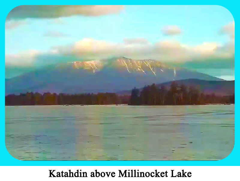
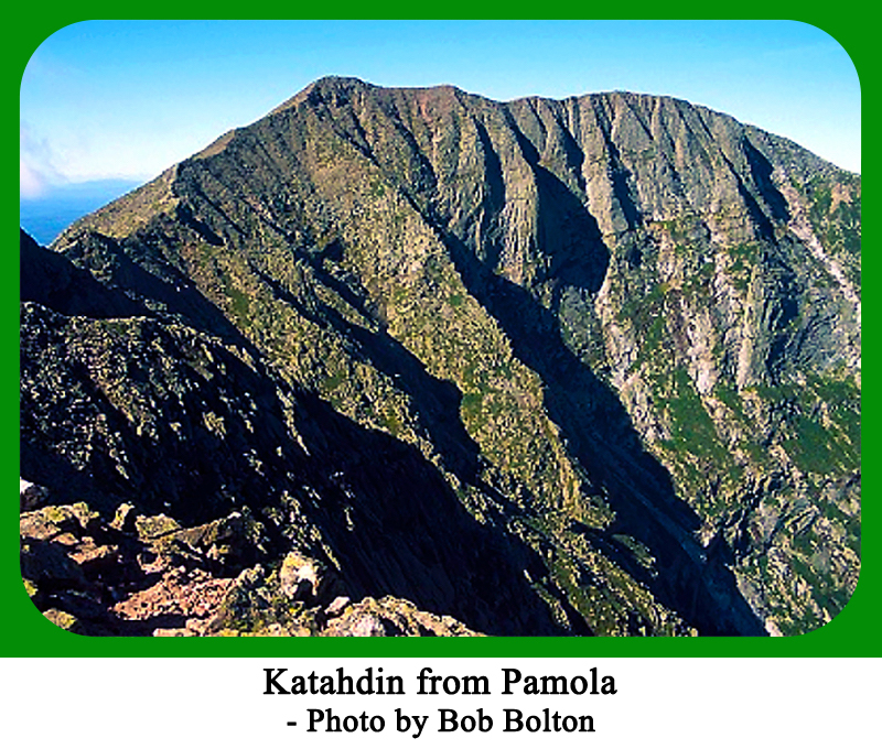
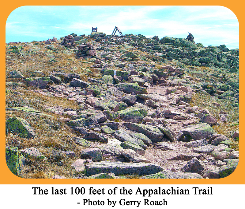
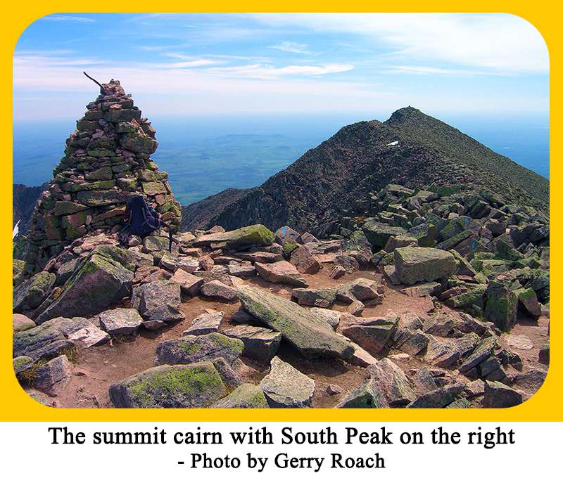
Maine’s highest peak and the 22nd highest US state summit, 5,268-foot Mount Katahdin is located in north central Maine, 95 miles northwest of Bangor, Maine. With 4,293 feet of prominence, Mount Katahdin is the most prominent peak in Maine. Mount Katahdin is the most northern state highpoint in the eastern US, and as such, has weather concerns that it’s southen neighbors do not have. Katahdin’s summit marks the northern end of the 2,160 mile Appalachian Trail. Also, Mount Katahdin is the lowest of the state summits over 5,000 feet. The title Mount Katahdin refers to the enire massif; the highest point is called Baxter Peak.
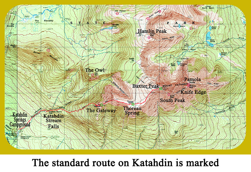
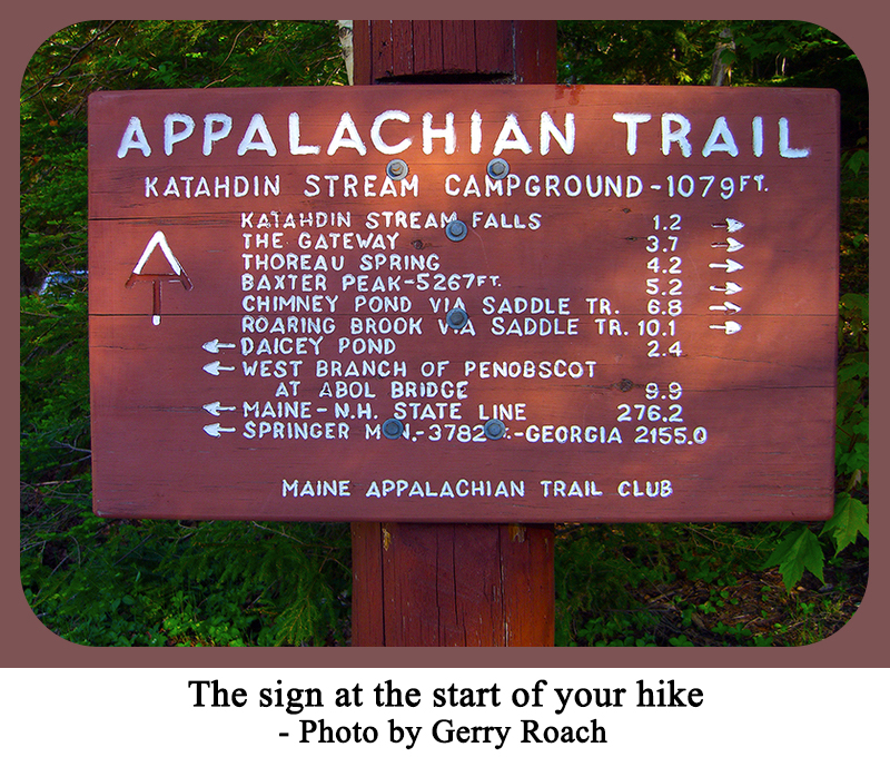
Mount Katahdin requires a strenuous hike of 10.4 miles round trip with an elevation gain of 4,195 feet. The typical hiking time is 8 to 10 hours. There is a trail most of the way, but there are tricky spots through some giant boulders about halfway up. Katahdin is in Baxter State Park that is normally open from May 15th to October 15th. Access to the park is on a first come, first served basis. If you arrive at the trailhead parking lot, and it is full, the area is closed. This rule acts as a quota system. Be sure to arrive early for your day hike, especially on a weekend! The park gates open at 6 am early in the season, and at 5 am during the summer. The park gates close at 10 pm. There is a fee for using this trailhead. To reach this trailhead, take exit 56 from I-95 onto state roads 11 and 157. Go 12 miles northwest to Millinocket, ME. From the stop light at Penobscot and Central Streets in Millinocket, go 16.6 miles west then north following signs for Baxter State Park to reach a visitor center. Continue north on the road to the park “Gatehouse” that is 18.0 miles from Millinocket. Pay the day use vehicle fee, then continue 5.7 miles left to Aboi Campground. Pass this campground and continue 2.0 more miles to the Katahdin Stream Campground. Turn left into this campground and park in the day use area.
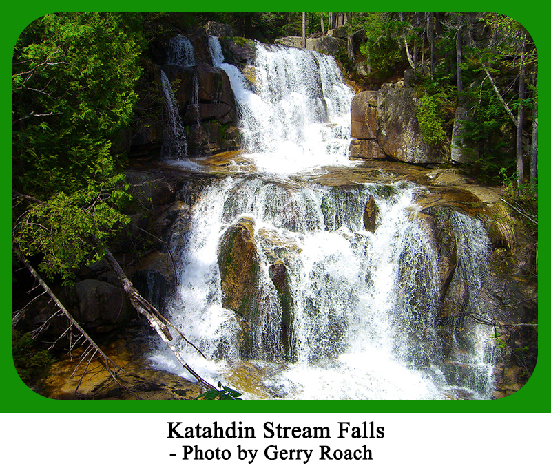
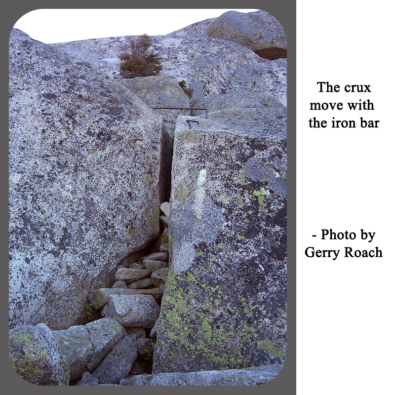
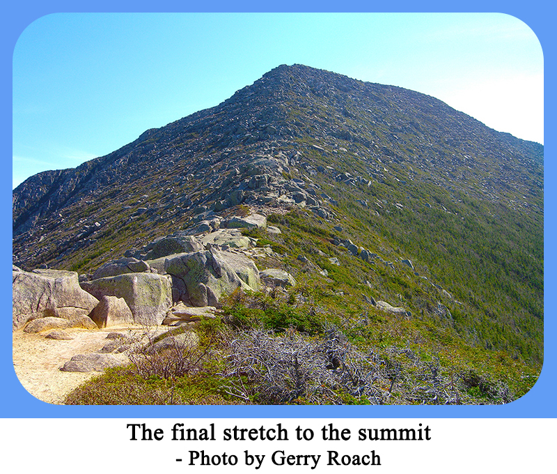
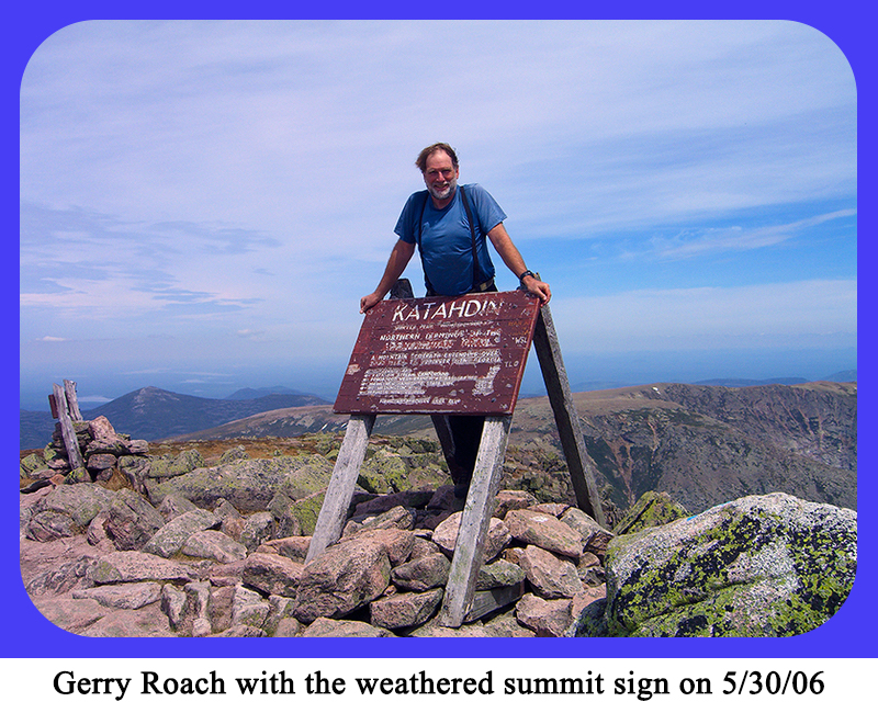
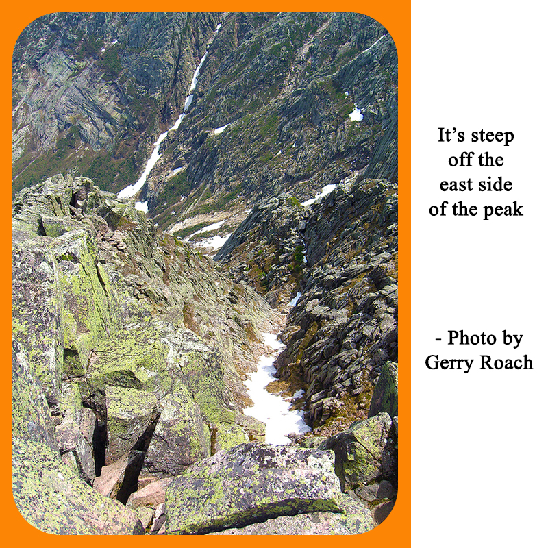
For your hike, follow the Hunt Trail northeast, that is the same as the AT. The AT is marked with white blazes. After an easy mile, reach a trail junction, go straight on the AT, and cross Katahdin Stream on a bridge. Turn left and climb to the picturesque Katahdin Stream Falls, which is a good place for a break. When ready, climb steeply east up a good rock stairway.The trail contunues to climb through the trees with some rock scampering to keep you awake. You will reach a feature called the “Cave” which is two large rocks leaning against each other. Shortly beyond the “Cave” is an area of large boulders that mark tree line. This is a good place to examine the weather, and possibly turn around if it looks like a storm is imminent. The rest of the hike is over rocks. Arrive at a near vertical pitch with a metal horizontal bar in it. Pull up on the bar, and grab a good hold above to surmount this pitch. If you feel compelled to avoid using the bar, reach far into the crack, discover a great handhold deep inside the crack, and use it instead of the bar. This move is a little harder than using the bar. Above this pitch, continue up across the rocks to the “the Gateway.” Here, your hard work is over, as you only have 700 feet of elevation gain remaining. Continue 0.5 mile up to Thoreau Spring and a trail junction where the Abol trail arrives from the Abol Campground. From here, you can see the summit that is only a mile away. Enjoy the last mile of the AT, and reach the famous sign on the summit. Posing with this sign proves that you have climbed Mount Katahdin. Enjoy the expansive views. |