State Highpoints Massachusetts - 3,487-foot Mount Greylock
Massachusetts’ highest peak and the 31st highest US state summit,
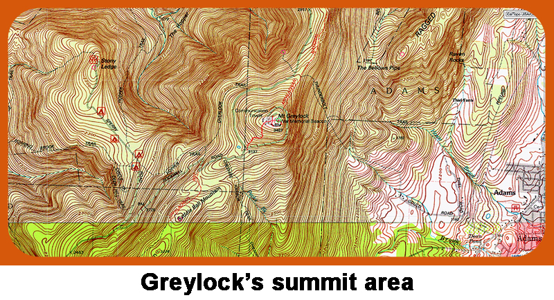
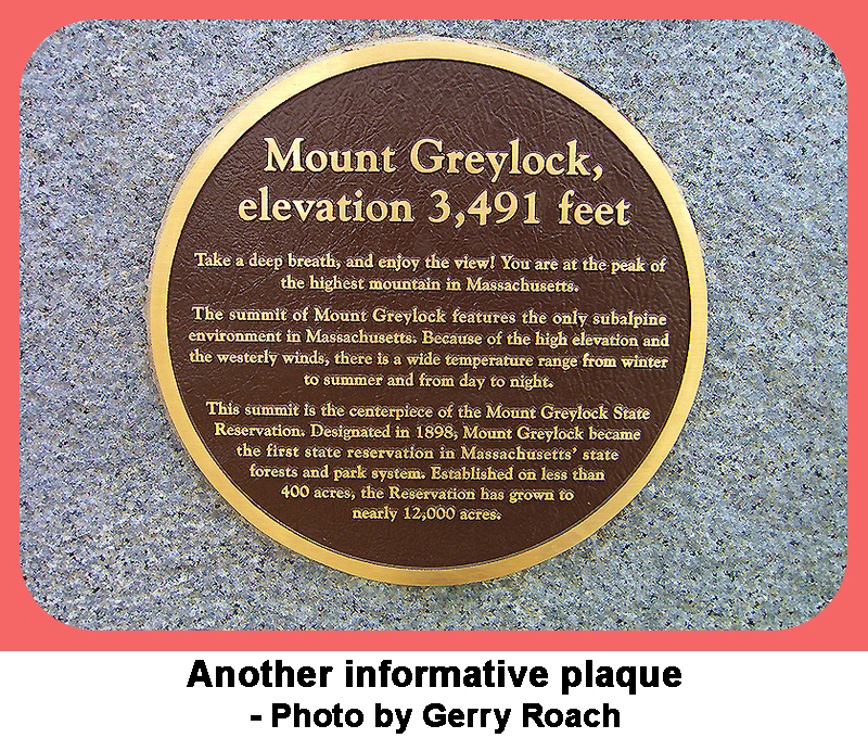
3,487-foot Mount Greylock is located in the far northwest portion of Massachusetts
not far from the borders with Vermont and New York.
With 2,474 feet of prominence, Mount Greylock is the most prominent peak in Massachusetts.
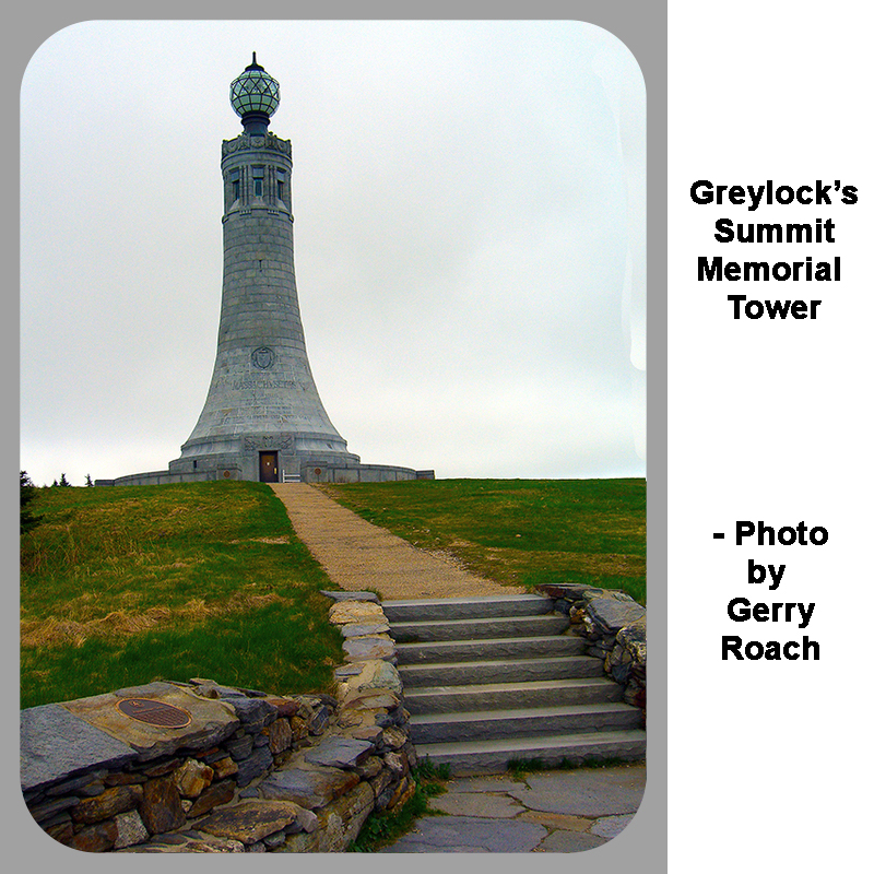
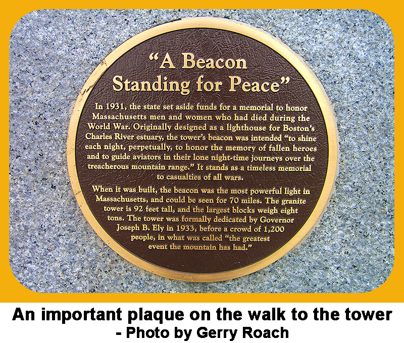
Mount Greylock is a driveup, is wheelchair accessible, and there is a big granite monument on the summit
that honors the men and women who died serving the USA.
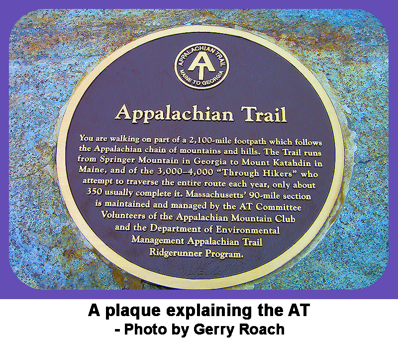
The Appalachian Trail goes over the summit, so there are several hiking options. Always yield to hikers.
To reach Mount Greylock, go to Pittsfield, MA, and drive 3 miles north on US 7 to a lake.
Continue to the north end of the lake to an intersection with Berkshire Mall Road.
Continue another 3 miles north on US 7, then turn right onto North Main Street
where there is a sign for the Greylock State Reservation.
Continue 0.7 mile to another intersection, and bear right onto Rockwell Road.
Continue on Rockwell Road for a short distance to the Mount Greylock Visitor Center
where you can pick up a map of the area.
From the Visitor Center, continue 5.5 miles north on the narrow, but paved Rockwell Road, and bear right at a fork.
After another 1.5 miles, you will come to a second fork, and again bear right.
Continue for the final 0.3 mile to the parking lot on top of Mount Greylock.
The road to the top of Mount Greylock is usually open from Mid May through early December.
It is a short walk from the parking lot to the summit monument, and you are free to roam around the summit area.
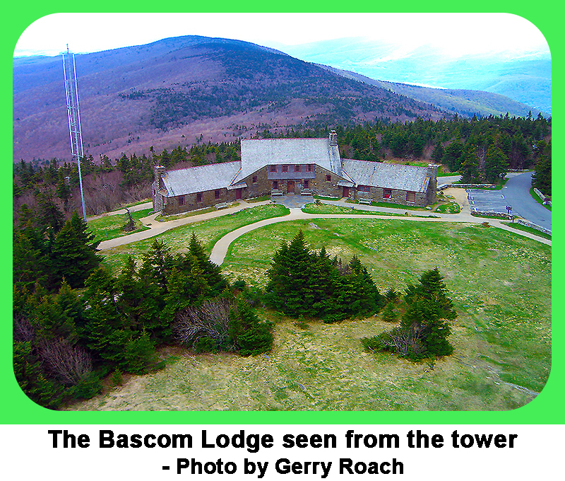
The historic Bascom Lodge is near the summit, built in the 1930s by the CCC.
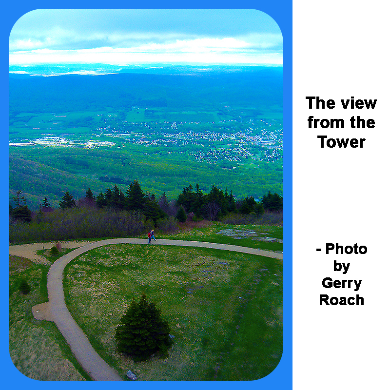
The views from this summit have moved many. |